Children are too rarely asked their perspectives on public spaces. Traditionally, adults make choices for children, particularly about how they live and play.
In yet-to-be-published research* on behalf of a local council, we asked 75 children aged 7-12 from ten primary schools in a disadvantaged area of Sydney to map what they value in their local area. Using iPads, children pinned images of their choices to specific locations on a digital map of the local government area. Some of their choices may surprise you.
Places children selected revealed the importance to them of sharing decision-making power. Placing a drawing of his local supermarket on the map, a nine-year-old boy explained his choice of “grocery shopping” because he could “spend time with mum and help decide what goes in our trolley”.
The children typically mapped places of leisure, such as parks, swimming pools and community centres, used outside school time when adults usually have most authority over children. Here children had more autonomy to be decision-makers and exercise agency. Mapping his local park, a ten-year-old boy commented:
I can do what I want here, and there are lots of different playthings to choose from."
Read more: 'Bang, bang, bang!': the shock of a boy playing with a gun on a suburban street
Pathways for change and belonging
Some children chose to map their school, seeing it as a pathway for change; they could imagine alternative futures with greater choices. An 11-year-old boy observed:
"School will help me get a good job."
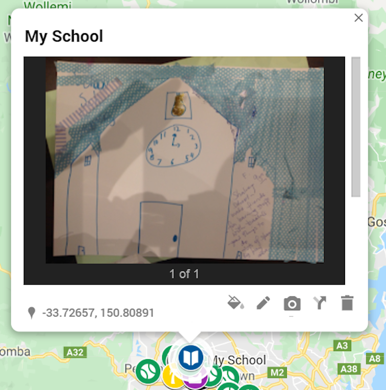
Others selected their school for the opportunities it offered them now. An eight-year-old girl, pressing sparkles around the clock on her drawing of her school before positioning it on the map, explained that there are:
"…lots of good things you can do at school. Read stories, have lots of space and a big play area."
 Some children chose their school, where there are ‘lots of good things you can do’. Children's digital map
Children’s choices also exposed the significance of places that promoted belonging and where they could make connections with others. A 10-year-old girl, mapping her local nature reserve, said:
"There is lots of space to play and I can make new friends there."
Similarly, an 11-year-old girl explained the importance of her community centre:
"It’s special because I have friends there."
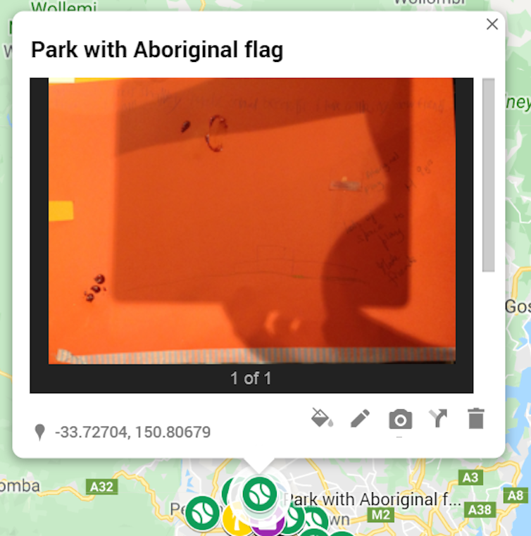
Countering a dominant story about belonging and identity that gives little recognition to original Indigenous land ownership in Australia, a ten-year-old Aboriginal girl used the map to draw an Aboriginal flag onto her local park. She observed:
"This is our land and I have fun here with my family."
 One girl chose her local park and drew an Aboriginal flag to show it’s ‘our land’. Children's digital map
Her claim on her local park is arguably not only about her own and her family’s belonging and identity but could also be read as referring to a broader body of Aboriginal people.
Read more: Refugees in their own land: how Indigenous people are still homeless in modern Australia
Children advocate for their families
By mapping their territory, children expressed their culture and sense of community through images, text and stories, recounting their valuable experiences and developing an alternative account of the public space.
Children experiencing disadvantage can be most reliant on what their urban environment offers. We were especially keen to unearth their viewpoints.
We found many of these children advocated for their families, not only themselves. Being able to access civic amenities free or at minimal cost was significant for their capacity to make choices and have spaces to connect with others.
A 12-year-old girl observed:
"For us to do things as a family, they have to be free."
And a nine-year-old boy said:
"We (speaking of his family) can do it if it’s free and we can go places if they are free."
A desire to take risks and explore
Children are increasingly watched and kept safe by adults. Many children mapped places where they represented themselves as risk-takers and explorers. They frequently connected their choices with mastering skills.
Read more: Why kids need risk, fear and excitement in play
Urban spaces along with bushland were repeatedly selected. These areas were, for some, bound up with “risk”, adventure and imagination. A 10-year-old boy mapping a nature reserve explained:
"That’s where I ride my motorbike. You get to see cows and pigs and horses and I’ve seen a crocodile in the dam."
Listing all the things she valued on her drawing of her local pool, a nine-year-old girl wrote:
"Has deep end and slide, good swimming teacher, try to swim butterfly to improve."
Her choices illustrated the children’s desire to experience their competency and capacity in environments where there are elements of risk.
Why digital mapping? Why not just ask children?
Children are a digital generation. Given the unequal power between adults and children, digital mapping helped us minimise adult intrusion, inviting children to present their spatial narratives.
Read more: Don't use technology as a bargaining chip with your kids
Their age, socio-economic status, race and other intersecting factors mean some children are more likely than others to have their perspectives heard. Digital mapping promised a more inclusive approach than traditional research methods provide.
The digital map gives children an opportunity to add their viewpoints to community planning rather than just reinforcing adult views. As local councils and planning authorities engage more with children to plan urban space, the perspectives of all children, including disadvantaged children, need to be heard.
*The data will be published in 2020. People interested in learning more about the research may contact the authors directly.
Fran Gale, Senior Lecturer, Social Work and Community Welfare, School of Social Science and Psychology, Western Sydney University and Michel Edenborough, Lecturer, Social Work and Community Welfare, Western Sydney University
This article is republished from The Conversation under a Creative Commons license. Read the original article.

